
Slopes & lifts
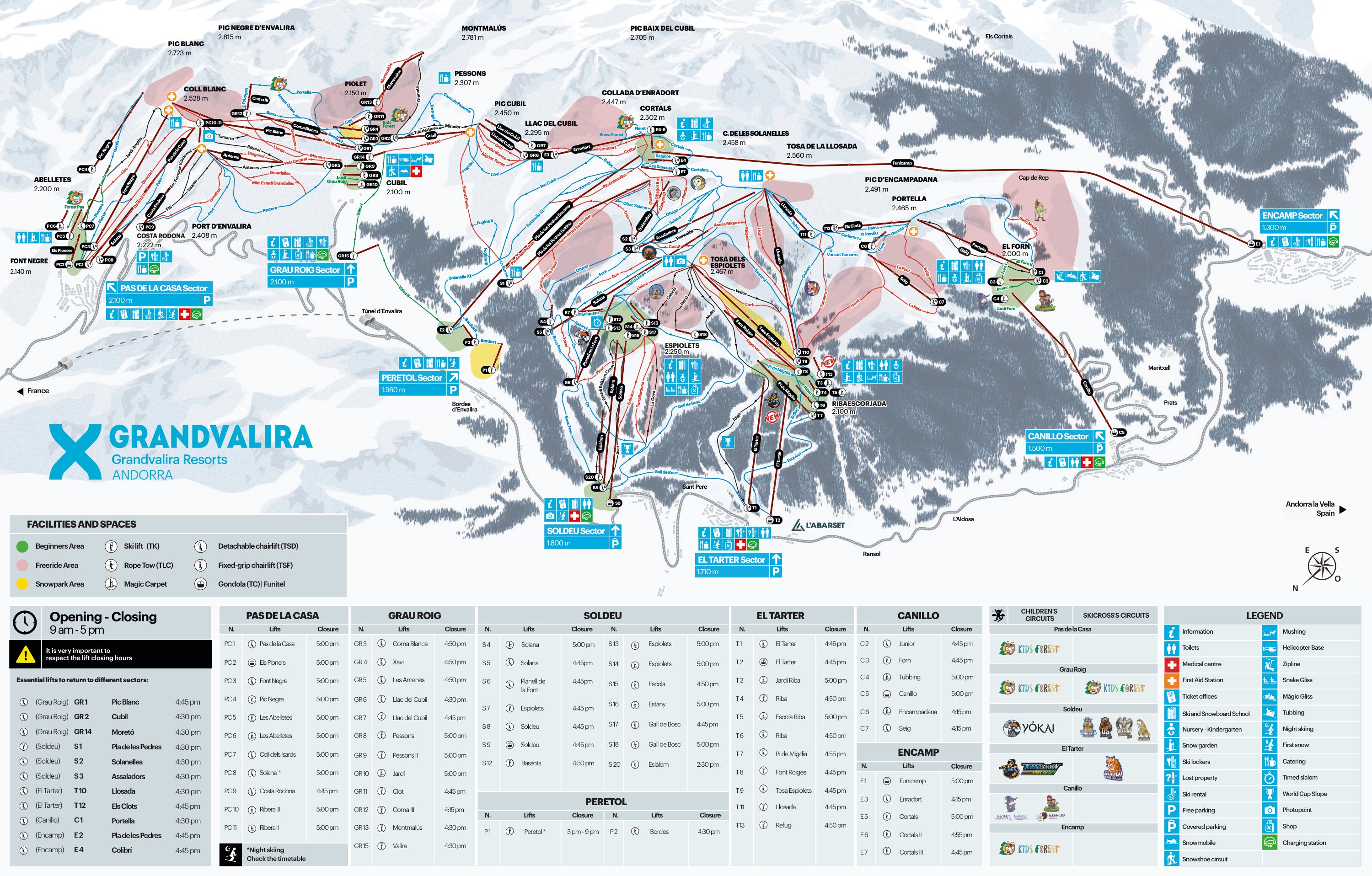
Grandvalira piste map.
Your 2025–26 Grandvalira piste map and Ordino-Arcalis piste map — every lift, run and sector at a glance.
The Grandvalira piste map covers the largest skiable domain in the Pyrenees — 215km of pistes across seven linked sectors: Soldeu, El Tarter, Canillo, Encamp, Grau Roig, Peretol and Pas de la Casa, all on one connected ski pass.
Given the size of the ski area, you'll most certainly benefit from having a Grandvalira piste map to hand to find your way around and make the most of the slopes. Use the interactive map below to zoom in, or download the Grandvalira piste map as a PDF to take with you.
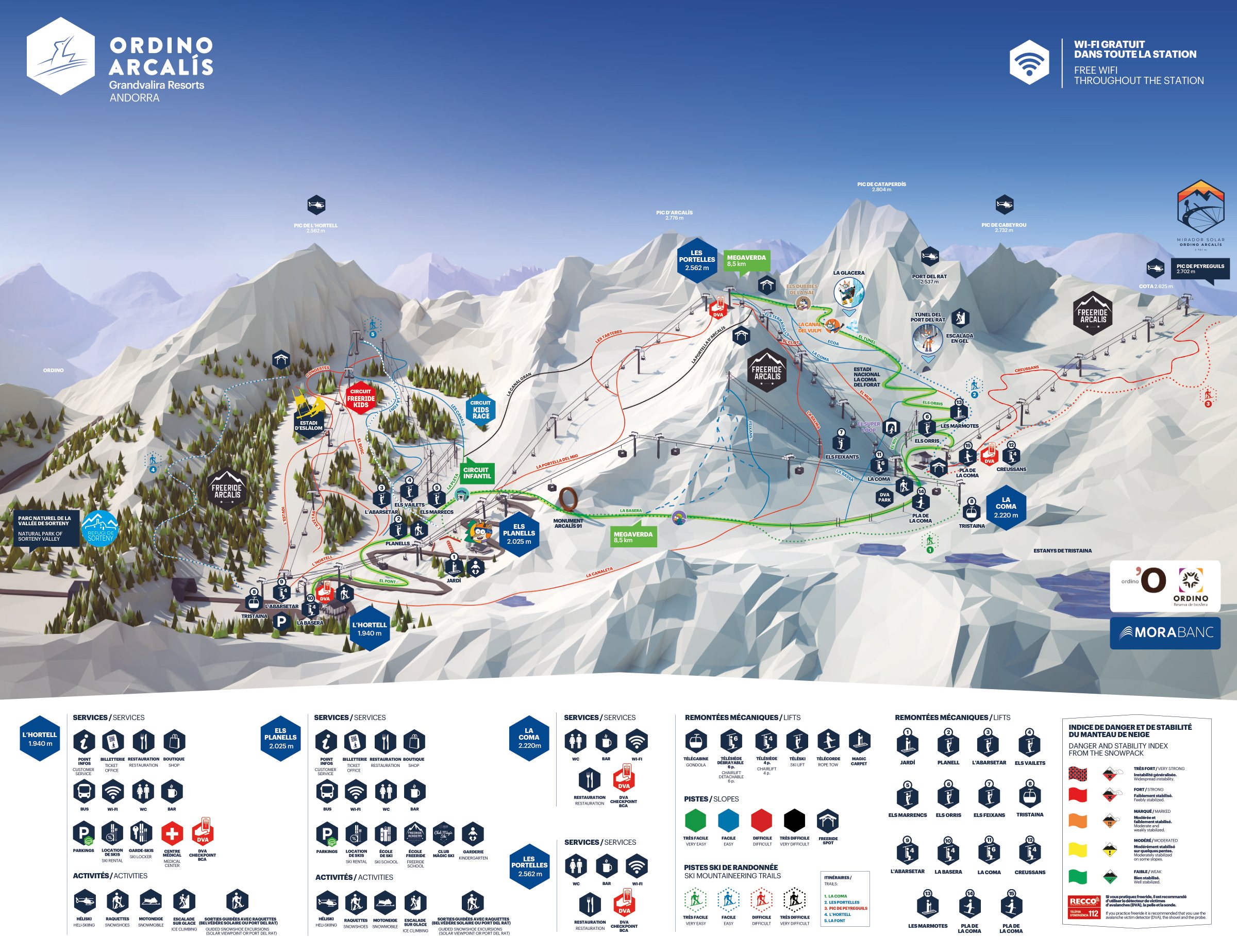
Your Grandvalira lift pass also covers Ordino-Arcalis — Andorra's third ski area, set in the quieter north of the country and well worth a day's exploration. The Ordino-Arcalis piste map is below the Grandvalira one.
On the mountain
Grandvalira piste map
The Grandvalira piste map below shows all seven sectors — Soldeu, El Tarter, Canillo, Encamp, Grau Roig, Peretol and Pas de la Casa — along with every lift, marked piste and mountain restaurant. Drag to pan, scroll or use the controls to zoom in.
Ordino-Arcalis piste map
The Ordino-Arcalis piste map covers the quieter ski area in northern Andorra — 27 pistes across roughly 30km of skiing. Ordino-Arcalis is now included with your Grandvalira lift pass, so it's easy to make a day trip across to explore.
Keep up to date
Sign up to our newsletter — twice a month, all year round, with the latest news, offers and upcoming events.
Why book with Andorra Resorts?
- Knowledgeable team
- We're local experts
- Everything confirmed before you arrive
- The best prices
- Our team on call during your holiday
Peace of mind
Every booking comes with free cancellation up to 21 days before your start date. Add cancellation protection at checkout and that extends to free cancellation up to 3 days before you go.
Learn more